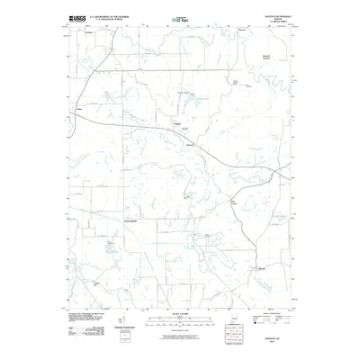
2010 Map of Augusta
USGS Topo · Published 2010About this map
The Patoka River and its numerous tributaries, including Mill Creek and Hog Branch, define the rural geography of this Pike County region. The landscape reflects a legacy of local industry and water management, evidenced by the Blackfoot Mine and extraction sites like Hoskins Pits. Small settlements such as Augusta, Hartwell, and Stendal are connected by a network of county roads, with several family and fraternal burial grounds including Corn Cemetery, Barre Cemetery, and the Odd Fellow Cemetery serving as important landmarks for genealogical research. Water features are prominent throughout the area, from the engineered Augusta Lake Dam and Enos Lake Dam to the natural flow of Beadens Creek and the South Fork Patoka River. The presence of the Hartwell Lookout Tower suggests the importance of fire observation for the surrounding timberlands, while the Pike Forest Horse Trl indicates the area's recreational use.
Find a feature on this map
58 named features on this map. Tap any name to fly to it.
Don’t see what you’re looking for? This feature index may not catch every label — zoom into the map to look around manually.
Map Details
Editions of this 2010 Augusta Map
This is the sole edition of this map. No revisions or reprints were ever made.
Other maps of this area

1900 · De Gonia Springs
USGS Topo · 1:62,500

1902 · Ditney
USGS Topo · 1:125,000

1902 · Degonia Springs
USGS Topo · 1:62,500

1902 · Boonville
USGS Topo · 1:62,500

1903 · Velpen
USGS Topo · 1:62,500

1903 · Petersburg
USGS Topo · 1:62,500

1956 · Vincennes
USGS Topo · 1:250,000

1957 · Vincennes
USGS Topo · 1:250,000

1958 · Vincennes
USGS Topo · 1:250,000
1960 · Folsomville
USGS Topo · 1:24,000