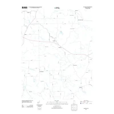
2013 Map of Augusta
USGS Topo · Published 2013About this map
Stendal and Augusta anchor this portion of Pike County, where the landscape is defined by the winding course of the Patoka River and its various tributaries. The region is characterized by a mix of small crossroads communities and agricultural land, interlaced with drainage features like Barren Ditch and Beadens Cr. Evidence of the area's industrial footprint is visible at Hoskins Pits and the Blackfoot Landfill, while the Hartwell Lookout Tower stands as a notable landmark near Hartwell Junction. This document provides a clear view of the rural road network, including Old State Hwy 64 and numerous county routes that connect outlying settlements like Ayrshire, Arthur, and Scottsburg. For local historians, the map preserves the exact locations of these small towns and the specific hydrography of the river forks and small lakes like Augusta Lake and Oxley Lake.
Find a feature on this map
67 named features on this map. Tap any name to fly to it.
Don’t see what you’re looking for? This feature index may not catch every label — zoom into the map to look around manually.
Map Details
Editions of this 2013 Augusta Map
This is the sole edition of this map. No revisions or reprints were ever made.
Other maps of this area

1900 · De Gonia Springs
USGS Topo · 1:62,500

1902 · Ditney
USGS Topo · 1:125,000

1902 · Degonia Springs
USGS Topo · 1:62,500

1902 · Boonville
USGS Topo · 1:62,500

1903 · Velpen
USGS Topo · 1:62,500

1903 · Petersburg
USGS Topo · 1:62,500

1956 · Vincennes
USGS Topo · 1:250,000

1957 · Vincennes
USGS Topo · 1:250,000

1958 · Vincennes
USGS Topo · 1:250,000
1960 · Folsomville
USGS Topo · 1:24,000