
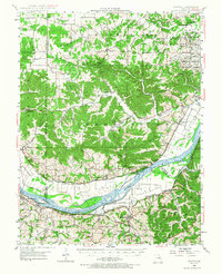
1948 Map of Augusta
USGS Topo · Published 1963About this map
The Missouri River winds along the southern edge of this landscape, framing a region defined by agricultural river bottoms and upland timber. In the late 1940s, the riverside communities of Augusta and Defiance served as local hubs, while the massive Weldon Spring Ordnance Works and the adjacent Augusta Busch Wildlife Area occupied the northeastern corner, reflecting the area's transition from wartime production to conservation.
Find a feature on this map
75 named features on this map. Tap any name to fly to it.
Don’t see what you’re looking for? This feature index may not catch every label — zoom into the map to look around manually.
Map Details
Editions of this 1948 Augusta Map
2 editions found
Other maps of this area

1890 · Hermann
USGS Topo · 1:125,000

1901 · De Soto
USGS Topo · 1:125,000

1903 · O'Fallon
USGS Topo · 1:125,000

1903 · Sullivan
USGS Topo · 1:125,000

1931 · Brussels
USGS Topo · 1:62,500

1937 · Pacific
USGS Topo · 1:24,000

1937 · Weldon Spring
USGS Topo · 1:24,000

1939 · Brussels
USGS Topo · 1:62,500

1940 · Eureka
USGS Topo · 1:24,000

1940 · Weldon Spring
USGS Topo · 1:24,000