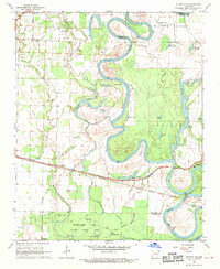
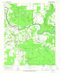
1968 Map of Augusta SW
USGS Topo · Published 1970About this map
The White River meanders through the central lowlands of White and Woodruff Counties, defining a landscape of oxbow lakes and wetlands. In the late 1960s, this area was characterized by its intricate drainage patterns, where features like Horseshoe Lake, Walker Lake, and Eagle Lake mark the former paths of the river. The Missouri Pacific railroad cuts a straight east-west line across the bottomland, connecting the riverside community of Augusta with smaller settlements such as Rio Vista and Worden.
Find a feature on this map
53 named features on this map. Tap any name to fly to it.
Don’t see what you’re looking for? This feature index may not catch every label — zoom into the map to look around manually.
Map Details
Editions of this 1968 Augusta SW Map
4 editions found
Other maps of this area

1932 · Kensett
USGS Topo · 1:62,500

1935 · Kensett
USGS Topo · 1:62,500

1935 · Augusta
USGS Topo · 1:62,500

1935 · Gregory
USGS Topo · 1:62,500

1935 · Bald Knob
USGS Topo · 1:62,500

1953 · Memphis
USGS Topo · 1:250,000

1956 · Memphis
USGS Topo · 1:250,000

1957 · Augusta
USGS Topo · 1:62,500

1957 · Gregory
USGS Topo · 1:62,500
1964 · West Point
USGS Topo · 1:24,000