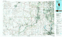
1985 Map of Aurora
USGS Topo · Published 1989About this map
The Fox River valley serves as the primary corridor for development in this mid-1980s portrait of northern Illinois. Massive suburban expansion is evident from the dense street grids of Naperville and Wheaton westward toward Aurora, while the western reaches of De Kalb County maintain a landscape of section lines and small agricultural centers like Somonauk and Leland. This contrast highlights the period when the Chicago metropolitan area was rapidly pushing into once-rural prairies, facilitated by the East-West Tollway.
Find a feature on this map
202 named features on this map. Tap any name to fly to it.
Don’t see what you’re looking for? This feature index may not catch every label — zoom into the map to look around manually.
Map Details
Editions of this 1985 Aurora Map
This is the sole edition of this map. No revisions or reprints were ever made.
Other maps of this area

1890 · Des Plaines
USGS Topo · 1:62,500

1891 · Riverside
USGS Topo · 1:62,500

1892 · Morris
USGS Topo · 1:62,500

1892 · Marseilles
USGS Topo · 1:62,500

1892 · Joliet
USGS Topo · 1:62,500

1892 · Wilmington
USGS Topo · 1:62,500

1892 · Ottawa
USGS Topo · 1:62,500

1893 · Riverside
USGS Topo · 1:62,500

1893 · Lasalle
USGS Topo · 1:62,500

1894 · Des Plaines
USGS Topo · 1:62,500