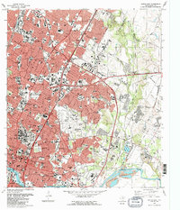
1988 Map of Austin East
USGS Topo · Published 1988About this map
The State Capitol and the dense institutional core of the Texas capital dominate the western edge of this survey, transitioning into the expanding residential and industrial corridors of the late 1980s. The landscape is defined by the Colorado River and Town Lake, with significant aviation history centered at the Robert Mueller Municipal Airport before its eventual decommissioning. Notable educational and cultural landmarks are scattered throughout, including the LBJ Library, Huston-Tillotson College, and the Texas School for the Blind.
Find a feature on this map
112 named features on this map. Tap any name to fly to it.
Don’t see what you’re looking for? This feature index may not catch every label — zoom into the map to look around manually.
Map Details
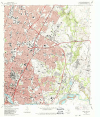
Editions of this 1988 Austin East Map
2 editions found
Other maps of this area

1896 · Austin
USGS Topo · 1:125,000

1897 · Austin
USGS Topo · 1:125,000

1910 · Austin
USGS Topo · 1:125,000

1932 · Mt. Bonnell
USGS Topo · 1:62,500

1954 · Austin East
USGS Topo · 1:24,000

1954 · Austin West
USGS Topo · 1:24,000

1954 · Austin
USGS Topo · 1:250,000

1955 · Montopolis
USGS Topo · 1:24,000

1955 · Oak Hill
USGS Topo · 1:24,000

1955 · Montopolis
USGS Topo · 1:62,500