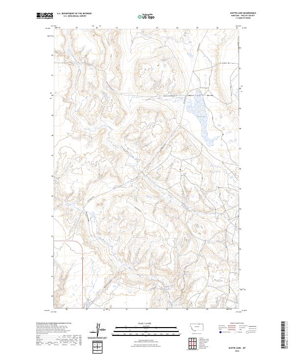
2024 Map of Austin Lake
USGS Topo · Published 2024About this map
Austin Lake sits at the heart of this high plains landscape in Phillips County, defining a region characterized by its drainage patterns and intermittent water sources. The terrain is deeply inscribed by several distinct coulees, including Lush Coulee, Martins Coulee, and Butte Coulee, which channel seasonal runoff through the undulating prairie. Human presence is marked primarily by ranching infrastructure and a network of remote roads such as Whitewater Rd and Loring Cutacross Rd. Managed water resources like Adair Reservoir and Plum Reservoir, along with the natural Austin Spring, highlight the critical importance of water management in this arid northern Montana environment. The map provides a clear look at the Public Land Survey System grid, illustrating the large-scale township and range divisions that dictate the modern land use and boundaries of this expansive territory.
Find a feature on this map
16 named features on this map. Tap any name to fly to it.
Don’t see what you’re looking for? This feature index may not catch every label — zoom into the map to look around manually.
Map Details
Editions of this 2024 Austin Lake Map
This is the sole edition of this map. No revisions or reprints were ever made.
Other maps of this area

1920 · Cowan
USGS Topo · 1:125,000

1954 · Glasgow
USGS Topo · 1:250,000

1957 · Glasgow
USGS Topo · 1:250,000

1958 · Glasgow
USGS Topo · 1:250,000

1968 · Tattnall
USGS Topo · 1:24,000
1968 · Hewitt Lake
USGS Topo · 1:24,000

1968 · Austin Lake
USGS Topo · 1:24,000

1968 · Hewitt Lake SW
USGS Topo · 1:24,000

1984 · Whitewater East
USGS Topo · 1:24,000

1984 · Austin Coulee
USGS Topo · 1:24,000