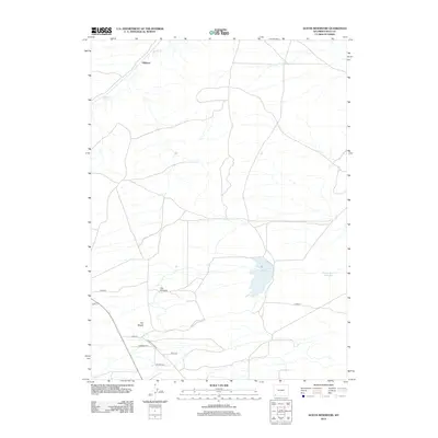
2012 Map of Austin Reservoir
USGS Topo · Published 2012About this map
The high plains of Uinta County are defined here by sparse settlement and vital water management infrastructure. Elkhurst stands as the primary named locale in this northern stretch of the county, situated near the meandering path of Muddy Cr. The landscape is punctuated by distinctive geological landmarks, most notably the prominent rises of The Pinnacle and The Nipple.
Find a feature on this map
13 named features on this map. Tap any name to fly to it.
Don’t see what you’re looking for? This feature index may not catch every label — zoom into the map to look around manually.
Map Details
Editions of this 2012 Austin Reservoir Map
This is the sole edition of this map. No revisions or reprints were ever made.
Other maps of this area

1954 · Ogden
USGS Topo · 1:250,000

1958 · Ogden
USGS Topo · 1:250,000

1960 · Ogden
USGS Topo · 1:250,000

1964 · Fort Bridger
USGS Topo · 1:24,000

1964 · Carter
USGS Topo · 1:24,000

1964 · Mountain View
USGS Topo · 1:24,000

1964 · Austin Reservoir
USGS Topo · 1:24,000
1965 · Millersville
USGS Topo · 1:24,000
1965 · Turtle Hill
USGS Topo · 1:24,000

1969 · Hampton
USGS Topo · 1:24,000