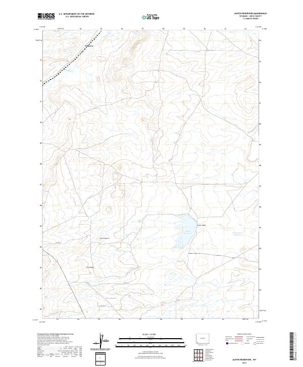
2021 Map of Austin Reservoir
USGS Topo · Published 2021About this map
Elkhurst anchors the northern reaches of this high-plains landscape in Uinta County, where the topography is defined by the winding course of Muddy Cr. The southwestern portion of the sheet features distinct geological landmarks such as The Pinnacle and The Nipple, which rise above the surrounding basin. This modern survey illustrates a quiet ranching and water-management landscape, dominated by the Austin Reservoir and Powers Stock Reservoir. These water bodies are connected by the broad expanse of the Austin Wash, which drains the central part of the quadrangle. A sparse network of local roads including Co RD 26 and Co RD 231 provide the primary access to this interior region, while named routes like Eagle Ln and Magpie Rd suggest more localized rural development or property access in the lower sections of the survey.
Find a feature on this map
17 named features on this map. Tap any name to fly to it.
Don’t see what you’re looking for? This feature index may not catch every label — zoom into the map to look around manually.
Map Details
Editions of this 2021 Austin Reservoir Map
This is the sole edition of this map. No revisions or reprints were ever made.
Other maps of this area

1954 · Ogden
USGS Topo · 1:250,000

1958 · Ogden
USGS Topo · 1:250,000

1960 · Ogden
USGS Topo · 1:250,000

1964 · Fort Bridger
USGS Topo · 1:24,000

1964 · Carter
USGS Topo · 1:24,000

1964 · Mountain View
USGS Topo · 1:24,000

1964 · Austin Reservoir
USGS Topo · 1:24,000
1965 · Millersville
USGS Topo · 1:24,000
1965 · Turtle Hill
USGS Topo · 1:24,000

1969 · Hampton
USGS Topo · 1:24,000