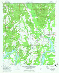
1982 Map of Autaugaville
USGS Topo · Published 1982About this map
Autaugaville serves as the focal point for this survey, situated just north of the expansive Jones Alabama River Bluff Lake. The landscape is defined by the sharp transition from the uplands down to the fertile plains of Dutch Bend, a prominent meander of the river along the southern boundary of Autauga Co. This area is characterized by a dense network of local family history markers, including several rural cemeteries such as Stoudenmire Cem and Rocky Hill Cem, which are scattered among established congregations like Dutch Bend Ch and Shiloh Ch.
Find a feature on this map
34 named features on this map. Tap any name to fly to it.
Don’t see what you’re looking for? This feature index may not catch every label — zoom into the map to look around manually.
Map Details
Editions of this 1982 Autaugaville Map
This is the sole edition of this map. No revisions or reprints were ever made.
Other maps of this area

1891 · Clanton
USGS Topo · 1:125,000

1953 · Montgomery
USGS Topo · 1:250,000

1956 · Montgomery
USGS Topo · 1:250,000

1957 · Montgomery
USGS Topo · 1:250,000

1957 · Autaugaville
USGS Topo · 1:62,500

1957 · Benton
USGS Topo · 1:62,500

1959 · Plantersville
USGS Topo · 1:62,500

1959 · Billingsley
USGS Topo · 1:62,500

1975 · Benton SE
USGS Topo · 1:24,000

1975 · Autaugaville SW
USGS Topo · 1:24,000