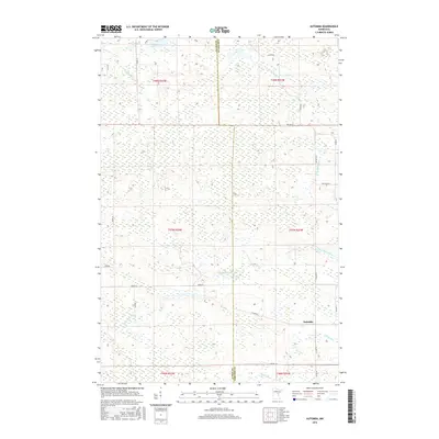
2016 Map of Automba
USGS Topo · Published 2016About this map
The Automba settlement and the rural border between Aitkin and Carlton Counties define this Northwoods landscape. The region is heavily characterized by its hydrological network, where the headwaters of the W Br Kettle River and the winding course of the Dead Moose River cut through the terrain. In the northwestern corner, Jay Lake and Nelson Lake anchor a series of lowlands that feed into the Sandy River. The transportation pattern reflects a township system dependent on local access roads like S Finn Rd and Erickson Rd, alongside Co Hwy 6, which connects the small community of Automba to the surrounding timber and wetland regions. This topographic study reveals the intricate drainage patterns of Silver Cr and the complex township and range boundaries that have governed land use in this part of Minnesota for over a century.
Find a feature on this map
30 named features on this map. Tap any name to fly to it.
Don’t see what you’re looking for? This feature index may not catch every label — zoom into the map to look around manually.
Map Details
Editions of this 2016 Automba Map
This is the sole edition of this map. No revisions or reprints were ever made.
Other maps of this area

1953 · Duluth
USGS Topo · 1:250,000

1958 · Duluth
USGS Topo · 1:250,000

1961 · Cromwell
USGS Topo · 1:62,500

1961 · Moose Lake
USGS Topo · 1:62,500

1969 · Split Rock Lake
USGS Topo · 1:24,000

1969 · Ronald
USGS Topo · 1:24,000

1969 · Automba
USGS Topo · 1:24,000

1969 · Lawler
USGS Topo · 1:24,000

1970 · Tamarack
USGS Topo · 1:24,000

1970 · Wright
USGS Topo · 1:24,000