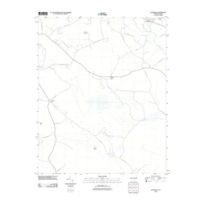
2010 Map of Autryville
USGS Topo · Published 2010About this map
Autryville anchors the northeast corner of this 2010 survey, situated near the winding course of the South River. This landscape in Cumberland County is defined by its complex hydrology, where sluggish waterways like Vineyard Swamp, Gallberry Swamp, and Reedy Marsh weave through the terrain. The network of local roads, many bearing family names such as Sidney Bullard Rd and Troy Fisher Rd, reveals a rural settlement pattern deeply connected to these wetlands. To the west, the Cedar Creek Lookout Tower stands as a notable landmark overlooking the intersection of Bogie Island Rd and Turnbull Rd. The presence of the Johnson Cemetery near the town center provides a point of interest for genealogists tracing local families in this portion of the Coastal Plain, while the drainage of Beaver Dam Creek and Turnbull Creek illustrates the natural low-lying topography of the region.
Find a feature on this map
33 named features on this map. Tap any name to fly to it.
Don’t see what you’re looking for? This feature index may not catch every label — zoom into the map to look around manually.
Map Details
Editions of this 2010 Autryville Map
This is the sole edition of this map. No revisions or reprints were ever made.
Other maps of this area

1948 · Fayetteville
USGS Topo · 1:62,500

1949 · Vander
USGS Topo · 1:24,000

1953 · Florence
USGS Topo · 1:250,000

1953 · Raleigh
USGS Topo · 1:250,000

1954 · Florence
USGS Topo · 1:250,000

1954 · Raleigh
USGS Topo · 1:250,000

1957 · Vander
USGS Topo · 1:24,000

1957 · Fayetteville
USGS Topo · 1:62,500

1959 · Roseboro
USGS Topo · 1:62,500

1959 · Saint Pauls
USGS Topo · 1:62,500