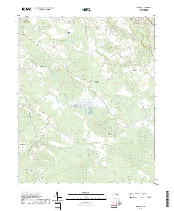
2022 Map of Autryville
USGS Topo · Published 2022About this map
Autryville and Stedman anchor this landscape along the border of Sampson and Cumberland Counties, defined by an intricate network of wetlands known as bays and swamps. The South River meanders along the eastern edge, serving as a primary drainage for the surrounding lowlands. The area is characterized by numerous distinct Carolina bays, such as Harrison Creek Bay, Buckhorn Bay, and Black Ground Bay, which illustrate the unique geomorphology of the coastal plain.
Find a feature on this map
66 named features on this map. Tap any name to fly to it.
Don’t see what you’re looking for? This feature index may not catch every label — zoom into the map to look around manually.
Map Details
Editions of this 2022 Autryville Map
This is the sole edition of this map. No revisions or reprints were ever made.
Other maps of this area

1948 · Fayetteville
USGS Topo · 1:62,500

1949 · Vander
USGS Topo · 1:24,000

1953 · Florence
USGS Topo · 1:250,000

1953 · Raleigh
USGS Topo · 1:250,000

1954 · Florence
USGS Topo · 1:250,000

1954 · Raleigh
USGS Topo · 1:250,000

1957 · Vander
USGS Topo · 1:24,000

1957 · Fayetteville
USGS Topo · 1:62,500

1959 · Roseboro
USGS Topo · 1:62,500

1959 · Saint Pauls
USGS Topo · 1:62,500