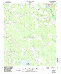
1987 Map of Autryville
USGS Topo · Published 1987About this map
The town of Autryville serves as the focal point for this coastal plain landscape, situated along the South River and the CSX railroad corridor. The area is defined by its numerous elliptical depressions known as Carolina Bays, including White Pond Bay, Buckhorn Bay, and Sewell Bay, which pattern the terrain alongside extensive wetlands like The Pocosin. The 1987 survey reveals a rural society anchored by localized religious life, with several rural churches such as Macedonia Ch, Christian Light Ch, and St Marks Ch serving the outlying communities.
Find a feature on this map
38 named features on this map. Tap any name to fly to it.
Don’t see what you’re looking for? This feature index may not catch every label — zoom into the map to look around manually.
Map Details
Editions of this 1987 Autryville Map
This is the sole edition of this map. No revisions or reprints were ever made.
Other maps of this area

1948 · Fayetteville
USGS Topo · 1:62,500

1949 · Vander
USGS Topo · 1:24,000

1953 · Florence
USGS Topo · 1:250,000

1953 · Raleigh
USGS Topo · 1:250,000

1954 · Florence
USGS Topo · 1:250,000

1954 · Raleigh
USGS Topo · 1:250,000

1957 · Vander
USGS Topo · 1:24,000

1957 · Fayetteville
USGS Topo · 1:62,500

1959 · Roseboro
USGS Topo · 1:62,500

1959 · Saint Pauls
USGS Topo · 1:62,500