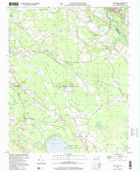
2002 Map of Autryville
USGS Topo · Published 2002About this map
Autryville anchors the northeastern corner of this coastal plain landscape, situated along the South River where the Sampson Co and Cumberland Co lines meet. The terrain is defined by a complex network of bays and pocosin wetlands, including The Pocosin and Piney Pocosin. Extensive water bodies like Bushy Lake, protected within the Bushy Lake State Natural Area, and the sprawling Simmons Mill Pond suggest a history of managed water resources and local conservation.
Find a feature on this map
36 named features on this map. Tap any name to fly to it.
Don’t see what you’re looking for? This feature index may not catch every label — zoom into the map to look around manually.
Map Details
Editions of this 2002 Autryville Map
This is the sole edition of this map. No revisions or reprints were ever made.
Other maps of this area

1948 · Fayetteville
USGS Topo · 1:62,500

1949 · Vander
USGS Topo · 1:24,000

1953 · Florence
USGS Topo · 1:250,000

1953 · Raleigh
USGS Topo · 1:250,000

1954 · Florence
USGS Topo · 1:250,000

1954 · Raleigh
USGS Topo · 1:250,000

1957 · Vander
USGS Topo · 1:24,000

1957 · Fayetteville
USGS Topo · 1:62,500

1959 · Roseboro
USGS Topo · 1:62,500

1959 · Saint Pauls
USGS Topo · 1:62,500