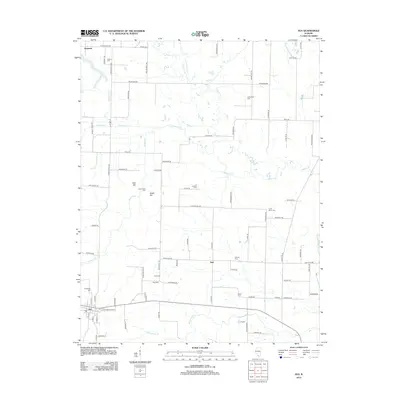
2012 Map of Ava
USGS Topo · Published 2012About this map
Ava serves as the primary hub for this portion of Jackson County, where the road network transitions from a dense town grid to the sprawling rural reaches of southwestern Illinois. The landscape is defined by the winding paths of Galum Cr and Rattlesnake Cr, which drain a countryside dotted with small family burial grounds and legacy settlements. Local history is deeply embedded in the terrain at Tater Hill and Sugar Hill, while the surrounding rural routes often bear the names of indigenous wildlife, such as Red Fox Rd and Mustang Rd. The distribution of scattered cemeteries like Evergreen Cem and Graff Cem highlights the genealogical value of this survey, preserving the locations of early homesteads and community centers like Sato and Bryden within the broader agricultural and wooded environment.
Find a feature on this map
88 named features on this map. Tap any name to fly to it.
Don’t see what you’re looking for? This feature index may not catch every label — zoom into the map to look around manually.
Map Details
Editions of this 2012 Ava Map
This is the sole edition of this map. No revisions or reprints were ever made.
Other maps of this area

1910 · Murphysboro
USGS Topo · 1:62,500

1914 · Coulterville
USGS Topo · 1:62,500

1916 · Campbell Hill
USGS Topo · 1:62,500

1917 · Coulterville
USGS Topo · 1:62,500

1918 · Campbell Hill
USGS Topo · 1:62,500

1924 · Pinckneyville
USGS Topo · 1:62,500

1926 · Pinckneyville
USGS Topo · 1:62,500

1938 · Murphysboro
USGS Topo · 1:62,500

1949 · Paducah
USGS Topo · 1:250,000

1950 · Paducah
USGS Topo · 1:250,000