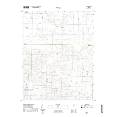
2018 Map of Ava
USGS Topo · Published 2018About this map
The boundary between Perry and Jackson Counties marks this landscape, where the town of Ava serves as a local hub. To the north and east, the small communities of Sato, Denmark, and Matthews connect via a network of rural roads, many of which carry the names of local wildlife such as Wolverine Rd, Prairie Dog Rd, and Chipmunk Rd. This survey captures a region defined by its numerous small burial grounds and rolling topography, featuring landmarks like Sugar Hill and Tater Hill. Genealogists will find a high concentration of family-named cemeteries, including Evergreen, Graff, and Birkner, clustered around the drainage basins of Pipestone Cr and Rattlesnake Cr. The distribution of these sites across the townships suggests a long-established rural settlement pattern that persists into the 21st century.
Find a feature on this map
89 named features on this map. Tap any name to fly to it.
Don’t see what you’re looking for? This feature index may not catch every label — zoom into the map to look around manually.
Map Details
Editions of this 2018 Ava Map
This is the sole edition of this map. No revisions or reprints were ever made.
Other maps of this area

1910 · Murphysboro
USGS Topo · 1:62,500

1914 · Coulterville
USGS Topo · 1:62,500

1916 · Campbell Hill
USGS Topo · 1:62,500

1917 · Coulterville
USGS Topo · 1:62,500

1918 · Campbell Hill
USGS Topo · 1:62,500

1924 · Pinckneyville
USGS Topo · 1:62,500

1926 · Pinckneyville
USGS Topo · 1:62,500

1938 · Murphysboro
USGS Topo · 1:62,500

1949 · Paducah
USGS Topo · 1:250,000

1950 · Paducah
USGS Topo · 1:250,000