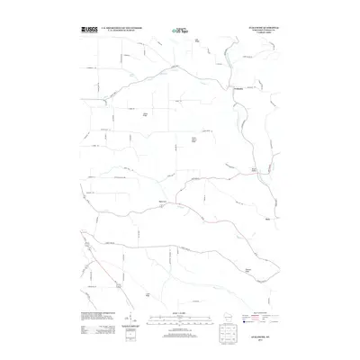
2013 Map of Avalanche
USGS Topo · Published 2013About this map
The W Fork Kickapoo River winds through the village of Avalanche, a central point in this rural landscape within Vernon County. The settlement pattern is defined by high ground, with numerous named ridges such as Asbury Ridge, East Ridge, and Pleasant Ridge separating the valley drainage systems. Water sources are abundant, including the Crume Spring and the localized Reservoir on Seas Br. The road network connecting small communities like Maple Dale and Ross follows the natural contours of the Driftless Area terrain, with routes like State Road 82 and County Hwy-SS crossing the various branches of the Kickapoo, such as Bishop Br and Cook Cr. This modern survey reflects the enduring agricultural character of the region, where family-named roads and remote valley hollows like Brush Hollow persist alongside well-established township corridors.
Find a feature on this map
68 named features on this map. Tap any name to fly to it.
Don’t see what you’re looking for? This feature index may not catch every label — zoom into the map to look around manually.
Map Details
Editions of this 2013 Avalanche Map
This is the sole edition of this map. No revisions or reprints were ever made.
Other maps of this area

1923 · Viroqua
USGS Topo · 1:62,500

1924 · Gays Mills
USGS Topo · 1:62,500

1926 · Gays Mills
USGS Topo · 1:62,500

1926 · Viroqua
USGS Topo · 1:62,500

1926 · La Farge
USGS Topo · 1:62,500

1933 · Boaz
USGS Topo · 1:62,500

1958 · La Crosse
USGS Topo · 1:250,000

1961 · La Crosse
USGS Topo · 1:250,000

1965 · La Crosse
USGS Topo · 1:250,000

1965 · La Farge
USGS Topo · 1:62,500