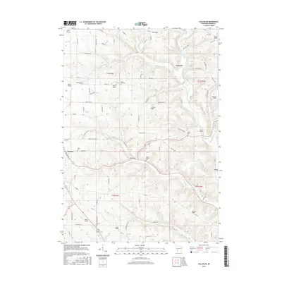
2016 Map of Avalanche
USGS Topo · Published 2016About this map
Coon Prairie and East Ridge define the elevated northern reaches of this Vernon County landscape, where the deeply incised valleys of the W Fork Kickapoo River system create a complex network of ridges and hollows. The small settlement of Avalanche sits at the confluence of several watercourses, including Seas Br. Historically, the distribution of rural cemeteries such as Zion Cem, Asbury Ridge Cem, and Bishop Branch Cem suggests the dispersed nature of early pioneer settlement and the importance of localized community hubs. The map reveals a land use pattern where ridge tops like Salem Ridge and Asbury Ridge are favored for agriculture and transport, while the narrower valleys or "hollows" like Brush Hollow contain specialized drainage systems. Settlements like Maple Dale and the eastern edge of Viroqua represent the transition from town centers to the surrounding uplands.
Find a feature on this map
87 named features on this map. Tap any name to fly to it.
Don’t see what you’re looking for? This feature index may not catch every label — zoom into the map to look around manually.
Map Details
Editions of this 2016 Avalanche Map
This is the sole edition of this map. No revisions or reprints were ever made.
Other maps of this area

1923 · Viroqua
USGS Topo · 1:62,500

1924 · Gays Mills
USGS Topo · 1:62,500

1926 · Gays Mills
USGS Topo · 1:62,500

1926 · Viroqua
USGS Topo · 1:62,500

1926 · La Farge
USGS Topo · 1:62,500

1933 · Boaz
USGS Topo · 1:62,500

1958 · La Crosse
USGS Topo · 1:250,000

1961 · La Crosse
USGS Topo · 1:250,000

1965 · La Crosse
USGS Topo · 1:250,000

1965 · La Farge
USGS Topo · 1:62,500