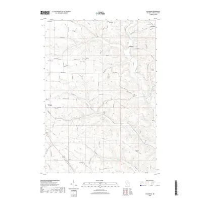
2018 Map of Avalanche
USGS Topo · Published 2018About this map
Coon Prairie and Round Prairie anchor the high ground of this Vernon County landscape, where the Coulee Region's characteristic ridges and valleys dictate the local geography. The rural character of the area is defined by a dense network of country roads, including Avalanche Rd and Haugrud Ridge Rd, which connect long-established farmsteads across Asbury Ridge and South Asbury Ridge. The settlement of Avalanche sits at a critical bend in the W Fork Kickapoo River, where it meets Seas Br. Genealogists will find a significant distribution of family and community burial grounds, such as Zion Cem, Asbury Ridge Cem, and the Bishop Branch Cem. These sites, along with the scattered namesake ridges like Fairview Ridge and Pleasant Ridge, illustrate a settlement pattern deeply tied to the dissected topography above the Black Bottom drainage.
Find a feature on this map
89 named features on this map. Tap any name to fly to it.
Don’t see what you’re looking for? This feature index may not catch every label — zoom into the map to look around manually.
Map Details
Editions of this 2018 Avalanche Map
This is the sole edition of this map. No revisions or reprints were ever made.
Other maps of this area

1923 · Viroqua
USGS Topo · 1:62,500

1924 · Gays Mills
USGS Topo · 1:62,500

1926 · Gays Mills
USGS Topo · 1:62,500

1926 · Viroqua
USGS Topo · 1:62,500

1926 · La Farge
USGS Topo · 1:62,500

1933 · Boaz
USGS Topo · 1:62,500

1958 · La Crosse
USGS Topo · 1:250,000

1961 · La Crosse
USGS Topo · 1:250,000

1965 · La Crosse
USGS Topo · 1:250,000

1965 · La Farge
USGS Topo · 1:62,500