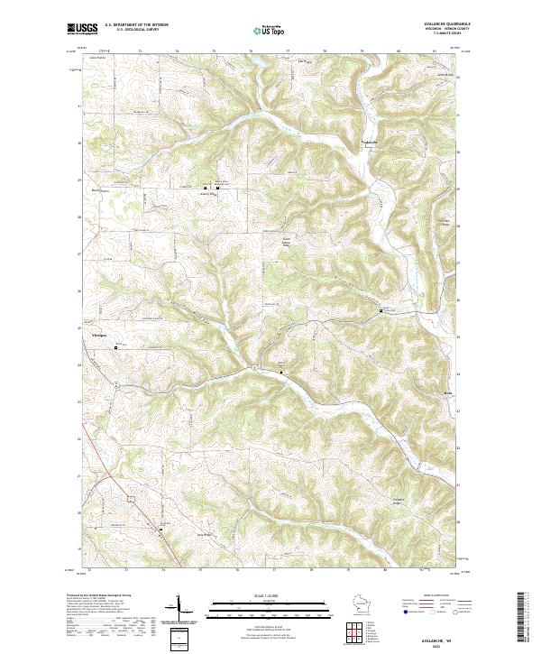
2022 Map of Avalanche
USGS Topo · Published 2022About this map
Coon Prairie and Round Prairie define the western high ground in this Vernon County landscape, where the terrain drops sharply into the winding valley of the W Fork Kickapoo River. The settlement of Avalanche sits at a critical junction where Seas Br meets the river, while the outskirts of Viroqua reach into the southwestern corner. This area is characterized by a high density of rural burial grounds, including Zion Cem and the Asbury Union Methodist Cem along Asbury Ridge. The complex drainage network of Cook Cr, Harrison Cr, and Reads Cr creates a deeply dissected topography of ridges such as Fairview Ridge and Pleasant Ridge. The low-lying Black Bottom in the south provides a stark contrast to the surrounding elevations, illustrating the classic driftless area geography of southwest Wisconsin.
Find a feature on this map
87 named features on this map. Tap any name to fly to it.
Don’t see what you’re looking for? This feature index may not catch every label — zoom into the map to look around manually.
Map Details
Editions of this 2022 Avalanche Map
This is the sole edition of this map. No revisions or reprints were ever made.
Other maps of this area

1923 · Viroqua
USGS Topo · 1:62,500

1924 · Gays Mills
USGS Topo · 1:62,500

1926 · Gays Mills
USGS Topo · 1:62,500

1926 · Viroqua
USGS Topo · 1:62,500

1926 · La Farge
USGS Topo · 1:62,500

1933 · Boaz
USGS Topo · 1:62,500

1958 · La Crosse
USGS Topo · 1:250,000

1961 · La Crosse
USGS Topo · 1:250,000

1965 · La Crosse
USGS Topo · 1:250,000

1965 · La Farge
USGS Topo · 1:62,500