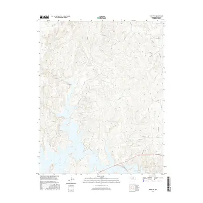
2016 Map of Avant NW
USGS Topo · Published 2016About this map
Skiatook Lake dominates the southern reaches of this Osage County landscape, where its irregular, finger-like shorelines fill the lower valleys. This area of Oklahoma is defined by a dense network of drainage systems, with Bull Cr and Cedar Cr carving through the terrain towards the larger Bird Creek basin. The map reveals a land transitioning between rugged natural features like Cedar Canyon and the encroaching rural infrastructure of the early 21st century.
Find a feature on this map
30 named features on this map. Tap any name to fly to it.
Don’t see what you’re looking for? This feature index may not catch every label — zoom into the map to look around manually.
Map Details
Editions of this 2016 Avant NW Map
This is the sole edition of this map. No revisions or reprints were ever made.
Other maps of this area

1909 · Pawhuska
USGS Topo · 1:125,000

1910 · Pawhuska
USGS Topo · 1:125,000

1912 · Hominy
USGS Topo · 1:125,000

1915 · Hominy
USGS Topo · 1:125,000

1915 · Hominy
USGS Topo · 1:62,500

1955 · Enid
USGS Topo · 1:250,000

1958 · Enid
USGS Topo · 1:250,000
1963 · Avant SE
USGS Topo · 1:24,000

1964 · Barnsdall
USGS Topo · 1:24,000
1964 · Wynona
USGS Topo · 1:24,000