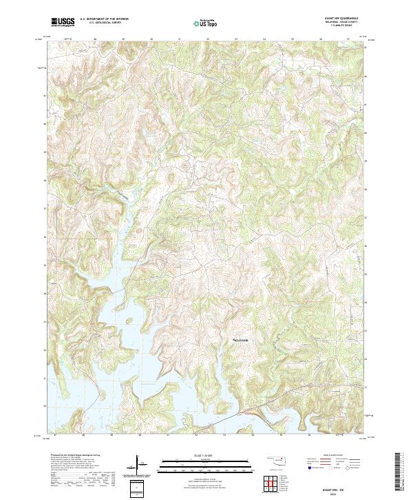
2022 Map of Avant NW
USGS Topo · Published 2022About this map
Skiatook Lake dominates the southern landscape of this Osage County region, its fingers reaching into the surrounding drainages of Lost Creek and Cedar Cr. The topography is characterized by a series of high ridges and deep draws, most notably Cedar Canyon, which drains toward the reservoir. While the northwestern portions of the map show a network of numbered county roads like Co RD 2140 and Co RD 2110 winding through the uplands, the southeastern corner reflects the outskirts of Skiatook. Here, the grid of named streets including 173rd St N and N 124th W Ave begins to meet the open country. Significant water management is evident through numerous upland impoundments such as 113064 Reservoir and 113065 Reservoir, which dot the hills north of the main lake.
Find a feature on this map
42 named features on this map. Tap any name to fly to it.
Don’t see what you’re looking for? This feature index may not catch every label — zoom into the map to look around manually.
Map Details
Editions of this 2022 Avant NW Map
This is the sole edition of this map. No revisions or reprints were ever made.
Other maps of this area

1909 · Pawhuska
USGS Topo · 1:125,000

1910 · Pawhuska
USGS Topo · 1:125,000

1912 · Hominy
USGS Topo · 1:125,000

1915 · Hominy
USGS Topo · 1:125,000

1915 · Hominy
USGS Topo · 1:62,500

1955 · Enid
USGS Topo · 1:250,000

1958 · Enid
USGS Topo · 1:250,000
1963 · Avant SE
USGS Topo · 1:24,000

1964 · Barnsdall
USGS Topo · 1:24,000
1964 · Wynona
USGS Topo · 1:24,000