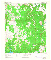
1966 Map of Avant SW
USGS Topo · Published 1967About this map
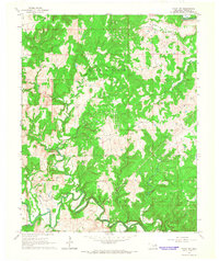
Oil and gas infrastructure dominates the landscape of Osage County in the mid-1960s, evidenced by the expansive network of named fields and production facilities. Significant operations are concentrated in the Wildhorse Oil Field and the Madalene Oil Field, where numerous Oil Wells and a central Tank Farm mark the industrial character of the region. The southern edge of the survey captures the rising waters of the Keystone Res, showing areas subject to controlled inundation.
Find a feature on this map
24 named features on this map. Tap any name to fly to it.
Don’t see what you’re looking for? This feature index may not catch every label — zoom into the map to look around manually.
Map Details
Editions of this 1966 Avant SW Map
3 editions found
Other maps of this area

1912 · Hominy
USGS Topo · 1:125,000

1915 · Hominy
USGS Topo · 1:125,000

1915 · Hominy
USGS Topo · 1:62,500

1955 · Enid
USGS Topo · 1:250,000

1956 · Sand Springs
USGS Topo · 1:24,000

1958 · Enid
USGS Topo · 1:250,000

1958 · Keystone Dam
USGS Topo · 1:24,000

1958 · Wekiwa
USGS Topo · 1:24,000
1963 · Avant SE
USGS Topo · 1:24,000
1966 · Avant NW
USGS Topo · 1:24,000