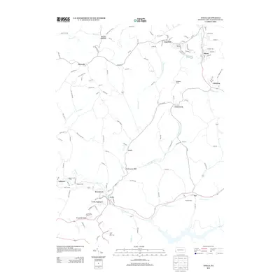
2013 Map of Avella
USGS Topo · Published 2013About this map
Meadowcroft Rock Shelter stands as a significant landmark in this section of Washington County, overlooking the winding waters of Cross Creek. The landscape is defined by the convergence of several major branches of the Cross Creek watershed, including North Fork Cross Creek, Middle Fork Cross Creek, and South Fork Cross Creek. These waterways historically shaped the settlement patterns seen here, from the established centers of Avella and Langeloth to smaller clusters like Pattersons Mill.
Find a feature on this map
123 named features on this map. Tap any name to fly to it.
Don’t see what you’re looking for? This feature index may not catch every label — zoom into the map to look around manually.
Map Details
Editions of this 2013 Avella Map
This is the sole edition of this map. No revisions or reprints were ever made.
Other maps of this area

1902 · Wheeling
USGS Topo · 1:62,500

1904 · Steubenville
USGS Topo · 1:62,500

1904 · Burgettstown
USGS Topo · 1:62,500

1906 · Burgettstown
USGS Topo · 1:62,500

1907 · Claysville
USGS Topo · 1:62,500

1935 · Wheeling
USGS Topo · 1:62,500

1935 · Steubenville
USGS Topo · 1:62,500

1942 · Wheeling
USGS Topo · 1:62,500

1942 · Steubenville
USGS Topo · 1:62,500

1951 · Canton
USGS Topo · 1:250,000
Featured Places
- Cross Creek Township, PA
- Independence Township, PA
- Jefferson Township, PA
- Langeloth, Smith Township
- Atlasburg, Smith Township