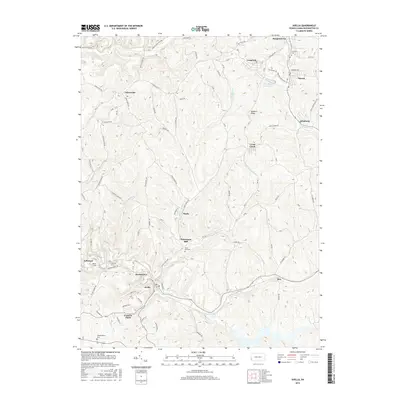
2016 Map of Avella
USGS Topo · Published 2016About this map
Pattersons Mill sits near the geographic center of this Washington County landscape, where the waters of Middle Fork Cross Cr and Cross Creek meet. The map reveals a dense network of rural roads and industrial remnants, including the Zinc Dam Reservoir near Langeloth and the sprawling residential clusters of Slovan, Atlasburg, and Avella. For genealogists and local historians, several burial grounds such as Fairview Cem and West End Cem are clearly marked alongside the small settlement of P and W Patch. Significant infrastructure is also visible, with the Bixton Tunnel and Craighead Tunnel cutting through the local ridges near Jefferson. This detailed topographical view provides a look at the modern footprint of these coal and industrial-era towns, showing how the local topography around Quakers Knob has influenced development from Burgettstown down to Rea.
Find a feature on this map
66 named features on this map. Tap any name to fly to it.
Don’t see what you’re looking for? This feature index may not catch every label — zoom into the map to look around manually.
Map Details
Editions of this 2016 Avella Map
This is the sole edition of this map. No revisions or reprints were ever made.
Other maps of this area

1902 · Wheeling
USGS Topo · 1:62,500

1904 · Steubenville
USGS Topo · 1:62,500

1904 · Burgettstown
USGS Topo · 1:62,500

1906 · Burgettstown
USGS Topo · 1:62,500

1907 · Claysville
USGS Topo · 1:62,500

1935 · Wheeling
USGS Topo · 1:62,500

1935 · Steubenville
USGS Topo · 1:62,500

1942 · Wheeling
USGS Topo · 1:62,500

1942 · Steubenville
USGS Topo · 1:62,500

1951 · Canton
USGS Topo · 1:250,000
Featured Places
- Cross Creek Township, PA
- Independence Township, PA
- Jefferson Township, PA
- Langeloth, Smith Township
- Atlasburg, Smith Township