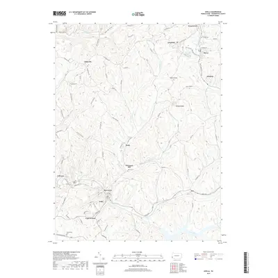
2019 Map of Avella
USGS Topo · Published 2019About this map
Avella and the surrounding townships in Washington County are defined by a complex network of stream forks and industrial remnants. This landscape is shaped by the Cross Creek watershed, including the Middle Fork Cross Cr and S Fork Cross Cr, where small settlements like Pattersons Mill and Studa are connected by winding rural routes. The northern reaches show a more industrial character near Burgettstown and Langeloth, where the Zinc Dam Reservoir and Bologna Industrial Rd suggest the area's manufacturing and resource extraction history. Genealogists can locate several local burial grounds, including Fairview Cem and West End Cem. Further south, the terrain becomes more isolated, featuring unusual local place names like Shades of Death Rd and the small enclave of P and W Patch, while transit history is preserved in landmarks such as the Craighead Tunnel and Bixton Tunnel.
Find a feature on this map
76 named features on this map. Tap any name to fly to it.
Don’t see what you’re looking for? This feature index may not catch every label — zoom into the map to look around manually.
Map Details
Editions of this 2019 Avella Map
This is the sole edition of this map. No revisions or reprints were ever made.
Other maps of this area

1902 · Wheeling
USGS Topo · 1:62,500

1904 · Steubenville
USGS Topo · 1:62,500

1904 · Burgettstown
USGS Topo · 1:62,500

1906 · Burgettstown
USGS Topo · 1:62,500

1907 · Claysville
USGS Topo · 1:62,500

1935 · Wheeling
USGS Topo · 1:62,500

1935 · Steubenville
USGS Topo · 1:62,500

1942 · Wheeling
USGS Topo · 1:62,500

1942 · Steubenville
USGS Topo · 1:62,500

1951 · Canton
USGS Topo · 1:250,000
Featured Places
- Cross Creek Township, PA
- Independence Township, PA
- Jefferson Township, PA
- Langeloth, Smith Township
- Atlasburg, Smith Township