2023 Map of Avella
USGS Topo · Published 2023About this map
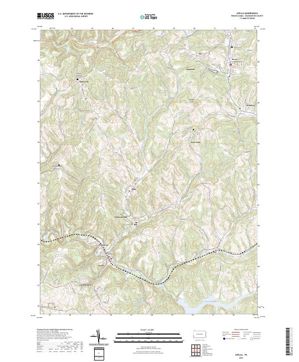
Avella and the surrounding townships in Washington County are defined by a complex drainage system where the North Fork Cross Creek and Middle Fork Cross Creek converge. The landscape is dotted with small, historically distinct settlements such as Eldersville, Studa, and Pattersons Mill, many of which developed around early industrial hubs or agricultural centers. The map reveals the area's transition into modern recreational space with the prominence of Cross Creek Lake and the Panhandle Trl, which follows a former rail corridor.
Find a feature on this map
97 named features on this map. Tap any name to fly to it.
Don’t see what you’re looking for? This feature index may not catch every label — zoom into the map to look around manually.
Map Details
Editions of this 2023 Avella Map
This is the sole edition of this map. No revisions or reprints were ever made.
Historical Maps of Avella Through Time
Featured Locations
- Independence Township, PA
- Jefferson Township, PA
- Cross Creek Township, PA
- Eldersville, Jefferson Township
- Langeloth, Smith Township