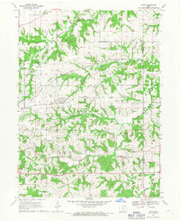
1968 Map of Avery
USGS Topo · Published 1971About this map
The settlement of Frederic and the surrounding coal-bearing hills of Monroe County define this 1960s landscape. This area is characterized by a dense network of drainage, where Miller Creek and the various branches of Avery Creek carve through the terrain. The presence of multiple Strip Mine operations and a Gravel Pit indicates an economy tied to the land's mineral resources, a common theme for this portion of southern Iowa.
Find a feature on this map
29 named features on this map. Tap any name to fly to it.
Don’t see what you’re looking for? This feature index may not catch every label — zoom into the map to look around manually.
Map Details
Editions of this 1968 Avery Map
2 editions found
Other maps of this area

1929 · Albia
USGS Topo · 1:62,500

1939 · Mystic
USGS Topo · 1:62,500

1942 · Mystic
USGS Topo · 1:62,500

1954 · Centerville
USGS Topo · 1:250,000

1954 · Des Moines
USGS Topo · 1:250,000

1956 · Des Moines
USGS Topo · 1:250,000

1957 · Des Moines
USGS Topo · 1:250,000

1957 · Centerville
USGS Topo · 1:250,000

1958 · Centerville
USGS Topo · 1:250,000
1968 · Blakesburg NE
USGS Topo · 1:24,000