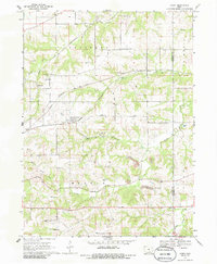
1968 Map of Avery
USGS Topo · Published 1986About this map
The Chicago Burlington And Quincy and Chicago And North Western railroads define the industrial and transit corridor of this Monroe County landscape in the late 1960s. The settlement of Avery serves as a central hub, surrounded by a heavy concentration of coal extraction sites labeled as Strip Mine. This mining activity is interspersed with numerous family and community landmarks, particularly along the drainage of North Avery Creek and Middle Avery Creek.
Find a feature on this map
30 named features on this map. Tap any name to fly to it.
Don’t see what you’re looking for? This feature index may not catch every label — zoom into the map to look around manually.
Map Details
Editions of this 1968 Avery Map
2 editions found
Other maps of this area

1929 · Albia
USGS Topo · 1:62,500

1939 · Mystic
USGS Topo · 1:62,500

1942 · Mystic
USGS Topo · 1:62,500

1954 · Centerville
USGS Topo · 1:250,000

1954 · Des Moines
USGS Topo · 1:250,000

1956 · Des Moines
USGS Topo · 1:250,000

1957 · Des Moines
USGS Topo · 1:250,000

1957 · Centerville
USGS Topo · 1:250,000

1958 · Centerville
USGS Topo · 1:250,000
1968 · Blakesburg NE
USGS Topo · 1:24,000