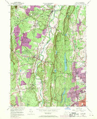
1957 Map of Avon
USGS Topo · Published 1970About this map
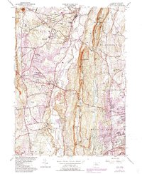
Talcott Mountain dominates the center of this landscape, forming a dramatic north-south ridge that separates the suburban expansion of West Hartford and Bloomfield from the Farmington River valley. The map documents a period of significant growth, with extensive suburban residential developments shown in purple revisions, particularly near Whitings Corner and along Albany Ave. The western portion of the quadrangle retains a more rural character, centered on the historic campus of Avon Old Farms and the estates of Simsbury.
Find a feature on this map
86 named features on this map. Tap any name to fly to it.
Don’t see what you’re looking for? This feature index may not catch every label — zoom into the map to look around manually.
Map Details
Editions of this 1957 Avon Map
6 editions found
Other maps of this area

1892 · Hartford
USGS Topo · 1:62,500

1892 · Meriden
USGS Topo · 1:62,500

1892 · Granby
USGS Topo · 1:62,500

1893 · Middletown
USGS Topo · 1:62,500

1893 · Meriden
USGS Topo · 1:62,500

1906 · Farmington
USGS Topo · 1:125,000

1928 · Windsor Locks
USGS Topo · 1:24,000

1928 · Windsor
USGS Topo · 1:24,000

1944 · Hartford South
USGS Topo · 1:31,680

1945 · Hartford North
USGS Topo · 1:31,680