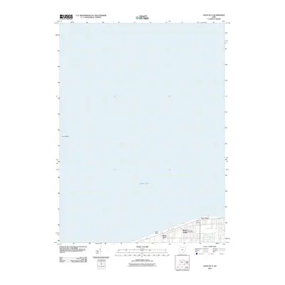
2010 Map of Avon OE N
USGS Topo · Published 2010About this map
Avon Lake sits prominently on the southern shore of Lake Erie, where the shoreline reaches northward at Avon Point. This 2010 survey focuses on the lakefront character of Lorain County, documenting the developed narrow strip of land between the water and the southern grid. Landmarks such as the Avon Lake Post Office and Lake Shore Cemetery anchor the community's local geography. The map illustrates the specialized drainage systems of the area, including Heider Ditch and Gable Ditch, which manage the water flow near the lakefront. Residential pockets like Beech Park and marine features like Avon Basin highlight the town's orientation toward the waterfront. To the west, the underwater contours of the Lorain Valley transition into the open expanse of the Great Lake, showing the bathymetry just off the coast.
Find a feature on this map
10 named features on this map. Tap any name to fly to it.
Don’t see what you’re looking for? This feature index may not catch every label — zoom into the map to look around manually.
Map Details
Editions of this 2010 Avon OE N Map
This is the sole edition of this map. No revisions or reprints were ever made.
Other maps of this area

1901 · Oberlin
USGS Topo · 1:62,500

1902 · Berea
USGS Topo · 1:62,500

1903 · Oberlin
USGS Topo · 1:62,500

1904 · Berea
USGS Topo · 1:62,500

1950 · Cleveland
USGS Topo · 1:250,000

1953 · Avon
USGS Topo · 1:24,000
1953 · North Olmsted
USGS Topo · 1:24,000

1956 · Cleveland
USGS Topo · 1:250,000

1956 · Toledo
USGS Topo · 1:250,000
1960 · Lorain
USGS Topo · 1:24,000