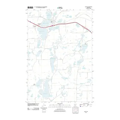
2010 Map of Avon
USGS Topo · Published 2010About this map
Avon serves as the central hub of this Stearns County landscape, where the Avon Post Office anchors a community defined by its proximity to the Spunk Lake chain. The topography is dominated by glacial water bodies, from the sprawling Upper Spunk Lake and Middle Spunk Lake in the north to the large expanse of Big Fish Lake further south. Modern transportation and recreation intersect here, as the Lake Wobegon Trl and major highway corridors cut through a region of dense woods and wetlands.
Find a feature on this map
83 named features on this map. Tap any name to fly to it.
Don’t see what you’re looking for? This feature index may not catch every label — zoom into the map to look around manually.
Map Details
Editions of this 2010 Avon Map
This is the sole edition of this map. No revisions or reprints were ever made.
Other maps of this area

1953 · Saint Cloud
USGS Topo · 1:250,000

1957 · Saint Cloud
USGS Topo · 1:250,000

1958 · Saint Cloud
USGS Topo · 1:250,000

1965 · Albany
USGS Topo · 1:24,000

1965 · St Stephen
USGS Topo · 1:24,000

1965 · Farming
USGS Topo · 1:24,000

1965 · Holdingford
USGS Topo · 1:24,000

1965 · St Joseph
USGS Topo · 1:24,000

1965 · Avon
USGS Topo · 1:24,000

1967 · Cold Spring
USGS Topo · 1:24,000