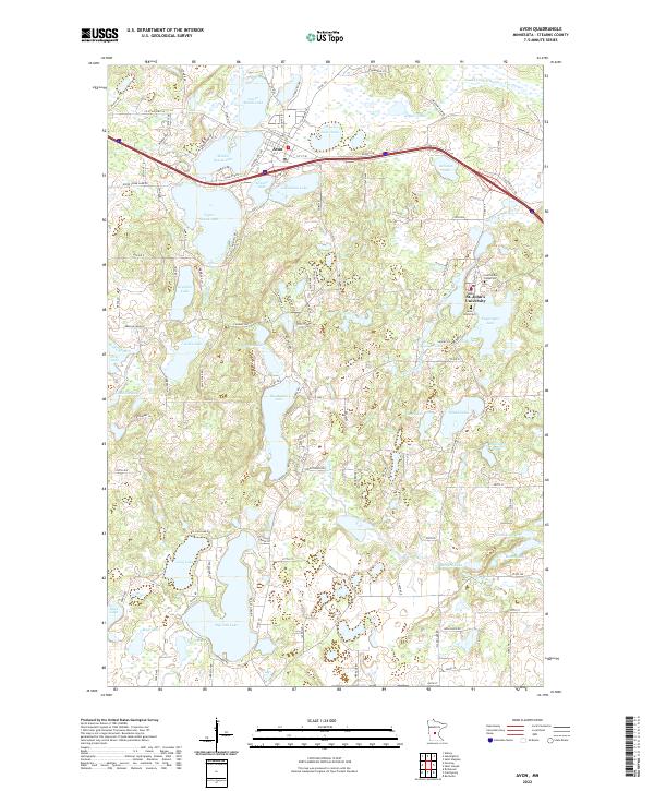
2022 Map of Avon
USGS Topo · Published 2022About this map
St. John's University and its surrounding monastic woodland anchor the eastern edge of this Stearns County landscape, where the waters of Sagatagan Lake meet the North Fork Watab River. The terrain is defined by a dense concentration of glacial basins, including the tripartite chain of Lower Spunk Lake, Middle Spunk Lake, and Upper Spunk Lake that surrounds the city of Avon. These water bodies, along with Big Watab Lake and Big Fish Lake, reflect a complex drainage system managed in part by features like County Ditch Number Twenty-five.
Find a feature on this map
121 named features on this map. Tap any name to fly to it.
Don’t see what you’re looking for? This feature index may not catch every label — zoom into the map to look around manually.
Map Details
Editions of this 2022 Avon Map
This is the sole edition of this map. No revisions or reprints were ever made.
Other maps of this area

1953 · Saint Cloud
USGS Topo · 1:250,000

1957 · Saint Cloud
USGS Topo · 1:250,000

1958 · Saint Cloud
USGS Topo · 1:250,000

1965 · Albany
USGS Topo · 1:24,000

1965 · St Stephen
USGS Topo · 1:24,000

1965 · Farming
USGS Topo · 1:24,000

1965 · Holdingford
USGS Topo · 1:24,000

1965 · St Joseph
USGS Topo · 1:24,000

1965 · Avon
USGS Topo · 1:24,000

1967 · Cold Spring
USGS Topo · 1:24,000