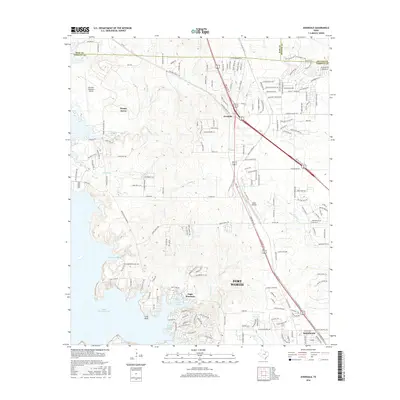
2016 Map of Avondale
USGS Topo · Published 2016About this map
Eagle Mountain Lake dominates the western edge of this Tarrant County landscape, where the waters reach into Flemming Slough and Carter Slough. The area north of Fort Worth is characterized by a mix of established aviation hubs and expanding residential corridors. Hicks Airfield and the Kenneth Copeland Airport serve as central landmarks for the region's transport network, while the small settlement of Avondale sits at the junction of modern thoroughfares like 81 287 and Avondale Haslet Rd.
Find a feature on this map
194 named features on this map. Tap any name to fly to it.
Don’t see what you’re looking for? This feature index may not catch every label — zoom into the map to look around manually.
Map Details
Editions of this 2016 Avondale Map
This is the sole edition of this map. No revisions or reprints were ever made.
Other maps of this area

1891 · Weatherford
USGS Topo · 1:125,000

1893 · Weatherford
USGS Topo · 1:125,000

1894 · Fort Worth
USGS Topo · 1:125,000

1924 · Sunset 4-d
USGS Topo · 1:48,000

1930 · Boyd
USGS Topo · 1:62,500

1932 · Springtown
USGS Topo · 1:62,500

1954 · Dallas
USGS Topo · 1:250,000

1954 · Sherman
USGS Topo · 1:250,000

1955 · Haltom City
USGS Topo · 1:24,000

1955 · Avondale
USGS Topo · 1:24,000