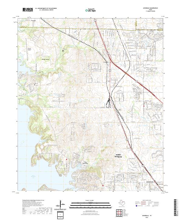
2022 Map of Avondale
USGS Topo · Published 2022About this map
Eagle Mountain Lake dominates the southwestern portion of this Tarrant County landscape, where the irregular shoreline of Flemming Slough and Dosier Slough creates a complex interface of water and land. This 2022 survey captures the northern expansion of Fort Worth and Saginaw, showing a transition from aviation-focused infrastructure at Hicks Airfield and the Kenneth Copeland Airport to rapidly developing residential networks. Local history is anchored by the Indian Creek Cem and Dido Cem, which stand near drainage systems like Indian Cr and Gilmore Br. The map also illustrates the convergence of Wise, Denton, and Tarrant counties, reflecting how modern transportation corridors like Avondale Haslet Rd and Highway 287 now bridge historically distinct settlements such as Avondale and Pecan Acres.
Find a feature on this map
212 named features on this map. Tap any name to fly to it.
Don’t see what you’re looking for? This feature index may not catch every label — zoom into the map to look around manually.
Map Details
Editions of this 2022 Avondale Map
This is the sole edition of this map. No revisions or reprints were ever made.
Other maps of this area

1891 · Weatherford
USGS Topo · 1:125,000

1893 · Weatherford
USGS Topo · 1:125,000

1894 · Fort Worth
USGS Topo · 1:125,000

1924 · Sunset 4-d
USGS Topo · 1:48,000

1930 · Boyd
USGS Topo · 1:62,500

1932 · Springtown
USGS Topo · 1:62,500

1954 · Dallas
USGS Topo · 1:250,000

1954 · Sherman
USGS Topo · 1:250,000

1955 · Haltom City
USGS Topo · 1:24,000

1955 · Avondale
USGS Topo · 1:24,000