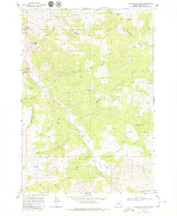
1968 Map of Axehandle Butte
USGS Topo · Published 1980About this map
Ashwood serves as the primary point of settlement in this Jefferson County landscape, where the high desert terrain is defined by volcanic features and an intricate network of intermittent springs. The map documents a rugged interior geography marked by prominent elevations like Axehandle Butte and Thompson Peak, alongside specialized landmarks such as the Axehandle Mine and a Borrow Pit near the northern boundary. Water management is central to this environment, evidenced by the numerous named sources like Axehandle Spring and the Gaging Station located along Trout Creek. Local ranching activity is anchored by the Norton Ranch in the southeast, situated near the confluence of Amity Creek and Gooseberry Creek. The abundance of jeep trails and survey marks reflects the area's mid-century character as a working landscape of mineral exploration and livestock grazing.
Find a feature on this map
34 named features on this map. Tap any name to fly to it.
Don’t see what you’re looking for? This feature index may not catch every label — zoom into the map to look around manually.
Map Details
Editions of this 1968 Axehandle Butte Map
2 editions found
Other maps of this area

1955 · Bend
USGS Topo · 1:250,000

1957 · Bend
USGS Topo · 1:250,000

1958 · Bend
USGS Topo · 1:250,000

1966 · Antelope
USGS Topo · 1:62,500

1966 · Willowdale
USGS Topo · 1:62,500

1968 · Horse Heaven Creek
USGS Topo · 1:24,000

1968 · Axehandle Butte
USGS Topo · 1:24,000

1968 · Dutchman Creek
USGS Topo · 1:24,000

1968 · Ashwood
USGS Topo · 1:24,000

1968 · Opal Mountain
USGS Topo · 1:24,000