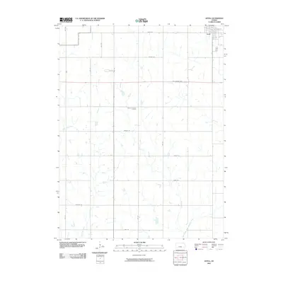
2009 Map of Axtell
USGS Topo · Published 2009About this map
Axtell anchors the northeast corner of this Kansas landscape, serving as a primary settlement node for the surrounding agricultural region. The terrain is defined by a dense network of watercourses, including the southern flow of the North Fork Black Vermillion River and its tributaries like Ackerman Creek and Snipe Creek. This rural section of Marshall County is partitioned by a grid of named section roads such as Jayhawk Rd and Matador Rd, reflecting the long-established land management patterns of the American Midwest. The Mission Covenant Cemetery stands as a significant local landmark for genealogical research, situated centrally within the quadrangle. Transportation history is also visible through the presence of the Pony Express Hwy, which cuts east-to-west across the plains, connecting the smaller homesteads and farms that dot the drainages of Little Timber Creek.
Find a feature on this map
22 named features on this map. Tap any name to fly to it.
Don’t see what you’re looking for? This feature index may not catch every label — zoom into the map to look around manually.
Map Details
Editions of this 2009 Axtell Map
This is the sole edition of this map. No revisions or reprints were ever made.
Other maps of this area

1889 · Seneca
USGS Topo · 1:125,000

1894 · Seneca
USGS Topo · 1:125,000

1955 · Manhattan
USGS Topo · 1:250,000

1956 · Manhattan
USGS Topo · 1:250,000

1957 · Manhattan
USGS Topo · 1:250,000
1966 · Seneca NW
USGS Topo · 1:24,000

1966 · Baileyville
USGS Topo · 1:24,000

1966 · Axtell
USGS Topo · 1:24,000
1966 · Summerfield
USGS Topo · 1:24,000
1966 · Beattie
USGS Topo · 1:24,000