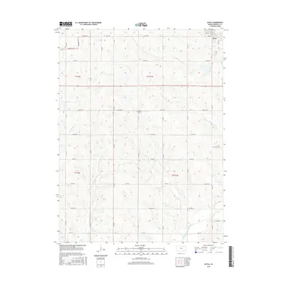
2016 Map of Axtell
USGS Topo · Published 2016About this map
Axtell anchors the northeastern corner of this Marshall County survey, showing the town's grid and its relationship to the surrounding agricultural landscape of the 21st century. The terrain is defined by the drainage basins of Snipe Cr, Little Timber Cr, and Ackerman Cr, all of which feed into the N Fork Black Vermillion River that winds through the southern reaches. This modern topographic study reveals a highly organized section-line road network, including many named routes like Indian Rd and Limestone Rd, that trace the legacy of the Public Land Survey System. Genealogists and local historians will find the Mission Covenant Cem centrally located along Limestone Rd, providing a specific geographic point for local family research in this prairie region.
Find a feature on this map
24 named features on this map. Tap any name to fly to it.
Don’t see what you’re looking for? This feature index may not catch every label — zoom into the map to look around manually.
Map Details
Editions of this 2016 Axtell Map
This is the sole edition of this map. No revisions or reprints were ever made.
Other maps of this area

1889 · Seneca
USGS Topo · 1:125,000

1894 · Seneca
USGS Topo · 1:125,000

1955 · Manhattan
USGS Topo · 1:250,000

1956 · Manhattan
USGS Topo · 1:250,000

1957 · Manhattan
USGS Topo · 1:250,000
1966 · Seneca NW
USGS Topo · 1:24,000

1966 · Baileyville
USGS Topo · 1:24,000

1966 · Axtell
USGS Topo · 1:24,000
1966 · Summerfield
USGS Topo · 1:24,000
1966 · Beattie
USGS Topo · 1:24,000