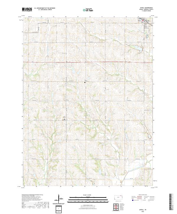
2022 Map of Axtell
USGS Topo · Published 2022About this map
Axtell sits at the northeastern corner of this Marshall County landscape, where the street grid of Maple St and Prairie St gives way to a sprawling network of agricultural roads named for historical and geographic markers. The terrain is defined by the winding paths of Ackerman Cr and Snipe Cr, which carve through the undulating plains before meeting larger drainage systems. For those researching the area's pioneer roots and early church communities, the presence of the Salem Lutheran Cem along Navajo Rd and the Mission Covenant Cem near Limestone Rd provides specific anchors for family history. The southern reaches of the map are marked by the N Fork Black Vermillion River, illustrating the natural watercourses that dictated early settlement patterns and land use in this part of Kansas.
Find a feature on this map
24 named features on this map. Tap any name to fly to it.
Don’t see what you’re looking for? This feature index may not catch every label — zoom into the map to look around manually.
Map Details
Editions of this 2022 Axtell Map
This is the sole edition of this map. No revisions or reprints were ever made.
Other maps of this area

1889 · Seneca
USGS Topo · 1:125,000

1894 · Seneca
USGS Topo · 1:125,000

1955 · Manhattan
USGS Topo · 1:250,000

1956 · Manhattan
USGS Topo · 1:250,000

1957 · Manhattan
USGS Topo · 1:250,000
1966 · Seneca NW
USGS Topo · 1:24,000

1966 · Baileyville
USGS Topo · 1:24,000

1966 · Axtell
USGS Topo · 1:24,000
1966 · Summerfield
USGS Topo · 1:24,000
1966 · Beattie
USGS Topo · 1:24,000