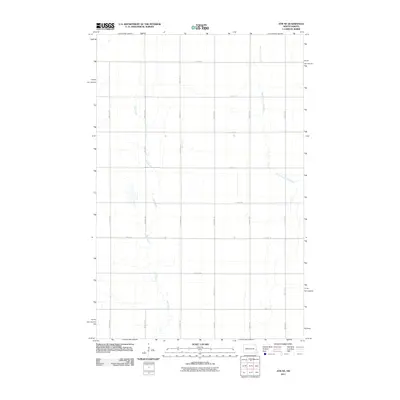
2011 Map of Ayr NE
USGS Topo · Published 2011About this map
Rush River and the South Branch Elm River meander through this section of Cass County, defining the drainage patterns of the Red River Valley’s prairie landscape. The area is structured by a rigid section-line road grid, where routes like 12th St SE and 148th Ave SE facilitate the agricultural movement essential to this part of North Dakota. This 2011 survey reflects a modern agricultural landscape that remains largely unchanged in its spatial organization from the original homestead era, though it is now viewed through the lens of high-resolution digital topography and satellite-derived road data. The map reveals the subtle topographic depressions where seasonal water gathers, illustrating how the natural hydrology of the Rush River basin interacts with the orderly human imposition of township and range lines.
Find a feature on this map
16 named features on this map. Tap any name to fly to it.
Don’t see what you’re looking for? This feature index may not catch every label — zoom into the map to look around manually.
Map Details
Editions of this 2011 Ayr NE Map
This is the sole edition of this map. No revisions or reprints were ever made.
Other maps of this area

1918 · Kelso
USGS Topo · 1:62,500

1943 · Kelso
USGS Topo · 1:62,500

1952 · Grand Forks
USGS Topo · 1:250,000

1956 · Grand Forks
USGS Topo · 1:250,000

1966 · Grand Forks
USGS Topo · 1:250,000

1966 · Galesburg
USGS Topo · 1:24,000

1967 · Ayr NE
USGS Topo · 1:24,000

1967 · Blanchard
USGS Topo · 1:24,000

1967 · Ayr NW
USGS Topo · 1:24,000
1967 · Hunter
USGS Topo · 1:24,000