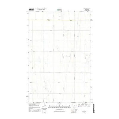
2014 Map of Ayr NE
USGS Topo · Published 2014About this map
Rush River and the S Br Elm River cut through the geometric grid of agricultural fields along the northern edge of Cass County in this 2014 survey. The landscape is defined by the strict sectional organization of the Red River Valley, where gravel and section roads like 12th St SE and 150th Ave SE mark the boundaries of extensive farmsteads. The Traill Co and Cass Co line runs through the upper portion of the quadrangle, illustrating the political geography of this productive prairie region. A notable point of interest is the Richtsmeier Airport, a private airstrip that emphasizes the practical role of aviation in modern large-scale farming operations. This map documents the persistent rural character and systematic land division that has shaped North Dakota since the original public land surveys.
Find a feature on this map
19 named features on this map. Tap any name to fly to it.
Don’t see what you’re looking for? This feature index may not catch every label — zoom into the map to look around manually.
Map Details
Editions of this 2014 Ayr NE Map
This is the sole edition of this map. No revisions or reprints were ever made.
Other maps of this area

1918 · Kelso
USGS Topo · 1:62,500

1943 · Kelso
USGS Topo · 1:62,500

1952 · Grand Forks
USGS Topo · 1:250,000

1956 · Grand Forks
USGS Topo · 1:250,000

1966 · Grand Forks
USGS Topo · 1:250,000

1966 · Galesburg
USGS Topo · 1:24,000

1967 · Ayr NE
USGS Topo · 1:24,000

1967 · Blanchard
USGS Topo · 1:24,000

1967 · Ayr NW
USGS Topo · 1:24,000
1967 · Hunter
USGS Topo · 1:24,000