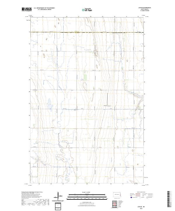
2024 Map of Ayr NE
USGS Topo · Published 2024About this map
The Cass County and Traill County line divides this agricultural landscape, defined by a strict section-line road grid and the meandering paths of prairie waterways. In the northern reaches, the South Branch Elm River cuts across the boundary, while the Rush River flows through the western sections, providing the primary natural relief in an otherwise systematically organized terrain.
Find a feature on this map
28 named features on this map. Tap any name to fly to it.
Don’t see what you’re looking for? This feature index may not catch every label — zoom into the map to look around manually.
Map Details
Editions of this 2024 Ayr NE Map
This is the sole edition of this map. No revisions or reprints were ever made.
Other maps of this area

1918 · Kelso
USGS Topo · 1:62,500

1943 · Kelso
USGS Topo · 1:62,500

1952 · Grand Forks
USGS Topo · 1:250,000

1956 · Grand Forks
USGS Topo · 1:250,000

1966 · Grand Forks
USGS Topo · 1:250,000

1966 · Galesburg
USGS Topo · 1:24,000

1967 · Ayr NE
USGS Topo · 1:24,000

1967 · Blanchard
USGS Topo · 1:24,000

1967 · Ayr NW
USGS Topo · 1:24,000
1967 · Hunter
USGS Topo · 1:24,000