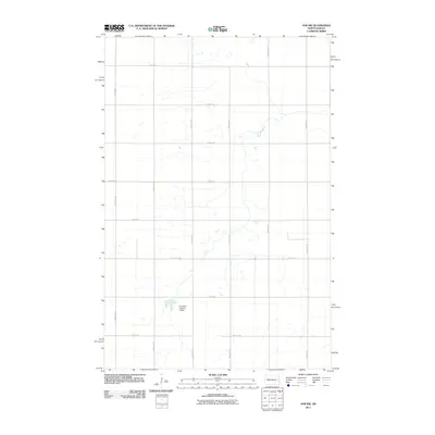
2011 Map of Ayr NW
USGS Topo · Published 2011About this map
Elm River Number 3 Dam anchors this specialized 2011 survey of Cass County, which highlights the highly structured agricultural landscape of Dows Township. The area is defined by a rigorous section-line road grid, where north-south routes like 142nd Ave SE and 147th Ave SE intersect east-west paths such as 12th St SE and 19th St SE at precise mile intervals. This pattern reflects the enduring legacy of the Public Land Survey System, which organized the Great Plains into productive farmsteads. Apart from the modern drainage and water management at the dam, the terrain is characterized by subtle hydrography and the dominant throughway of County Hwy-16, illustrating the intersection of natural water courses with the engineered efficiency of North Dakota’s rural infrastructure in the early 21st century.
Find a feature on this map
16 named features on this map. Tap any name to fly to it.
Don’t see what you’re looking for? This feature index may not catch every label — zoom into the map to look around manually.
Map Details
Editions of this 2011 Ayr NW Map
This is the sole edition of this map. No revisions or reprints were ever made.
Other maps of this area

1952 · Grand Forks
USGS Topo · 1:250,000

1956 · Grand Forks
USGS Topo · 1:250,000

1966 · Grand Forks
USGS Topo · 1:250,000

1966 · Galesburg
USGS Topo · 1:24,000

1966 · Hope SE
USGS Topo · 1:24,000

1967 · Page SE
USGS Topo · 1:24,000

1967 · Ayr NE
USGS Topo · 1:24,000

1967 · Ayr NW
USGS Topo · 1:24,000

1967 · Page
USGS Topo · 1:24,000
1967 · Ayr SE
USGS Topo · 1:24,000