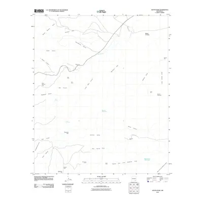
2010 Map of Azotea Peak
USGS Topo · Published 2010About this map
Azotea Mesa dominates this corner of the New Mexico high desert, a landscape defined by an intricate network of arroyos and canyons. Settlers and ranchers established their presence at points like the Old Jones Ranch and Denny Ranch, relying on critical water sources such as Walt Spring and the Rounds Waterhole. The map illustrates the specialized infrastructure of arid-land management, featuring the Spencer Dam and several eponymous draws that channel seasonal runoff.
Find a feature on this map
39 named features on this map. Tap any name to fly to it.
Don’t see what you’re looking for? This feature index may not catch every label — zoom into the map to look around manually.
Map Details
Editions of this 2010 Azotea Peak Map
This is the sole edition of this map. No revisions or reprints were ever made.
Other maps of this area

1940 · Bandanna Point
USGS Topo · 1:62,500

1943 · Bandanna Point
USGS Topo · 1:62,500

1943 · West Carlsbad
USGS Topo · 1:62,500

1945 · West Carlsbad
USGS Topo · 1:62,500

1954 · Seven Rivers
USGS Topo · 1:24,000

1954 · Carlsbad
USGS Topo · 1:250,000

1955 · Lake Mc Millan South
USGS Topo · 1:24,000

1957 · Foster Ranch
USGS Topo · 1:24,000

1958 · Carlsbad
USGS Topo · 1:250,000
1978 · Bandanna Point
USGS Topo · 1:24,000