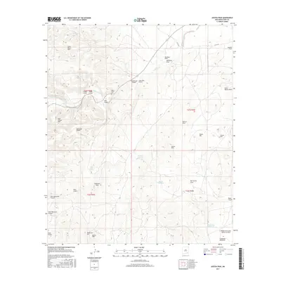
2017 Map of Azotea Peak
USGS Topo · Published 2017About this map
Rocky Arroyo winds through the northern reaches of this New Mexico landscape, a primary drainage point for the complex system of canyons and draws that define the local topography. This arid environment is marked by significant elevation changes, rising from the Seven Rivers Hills in the northwest to the high points of Nagooltee Peak and Azotea Peak in the south. The distribution of water sources, such as Indian Big Spring and Little Walt Spring, reveals the essential points of survival in this high desert terrain.
Find a feature on this map
36 named features on this map. Tap any name to fly to it.
Don’t see what you’re looking for? This feature index may not catch every label — zoom into the map to look around manually.
Map Details
Editions of this 2017 Azotea Peak Map
This is the sole edition of this map. No revisions or reprints were ever made.
Other maps of this area

1940 · Bandanna Point
USGS Topo · 1:62,500

1943 · Bandanna Point
USGS Topo · 1:62,500

1943 · West Carlsbad
USGS Topo · 1:62,500

1945 · West Carlsbad
USGS Topo · 1:62,500

1954 · Seven Rivers
USGS Topo · 1:24,000

1954 · Carlsbad
USGS Topo · 1:250,000

1955 · Lake Mc Millan South
USGS Topo · 1:24,000

1957 · Foster Ranch
USGS Topo · 1:24,000

1958 · Carlsbad
USGS Topo · 1:250,000
1978 · Bandanna Point
USGS Topo · 1:24,000