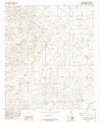
1985 Map of Azotea Peak
USGS Topo · Published 1985About this map
Azotea Mesa dominates this 1980s landscape in Eddy County, defining a complex topography of deep canyons and water-scarce draws. The map illustrates a series of dry drainages that channel seasonal runoff toward the north and east, including Seven Rivers and the aptly named Deadman Draw. Human activity in this arid environment is marked by essential water sources like Boyds Waterhole and Rain Spring, which likely served as vital landmarks for early ranchers and travelers in the region.
Find a feature on this map
29 named features on this map. Tap any name to fly to it.
Don’t see what you’re looking for? This feature index may not catch every label — zoom into the map to look around manually.
Map Details
Editions of this 1985 Azotea Peak Map
This is the sole edition of this map. No revisions or reprints were ever made.
Other maps of this area

1940 · Bandanna Point
USGS Topo · 1:62,500

1943 · Bandanna Point
USGS Topo · 1:62,500

1943 · West Carlsbad
USGS Topo · 1:62,500

1945 · West Carlsbad
USGS Topo · 1:62,500

1954 · Seven Rivers
USGS Topo · 1:24,000

1954 · Carlsbad
USGS Topo · 1:250,000

1955 · Lake Mc Millan South
USGS Topo · 1:24,000

1957 · Foster Ranch
USGS Topo · 1:24,000

1958 · Carlsbad
USGS Topo · 1:250,000
1978 · Bandanna Point
USGS Topo · 1:24,000