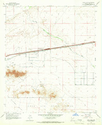
1965 Map of Aztec Hills
USGS Topo · Published 1966About this map
The Southern Pacific railroad corridor serves as the primary artery through this desert landscape, where the small settlement of Aztec stands near a concentration of borrow pits and wells. To the south, the Aztec Hills rise sharply from the basin, containing the White Mtn Mine and overlooking the expanse of the San Cristobal Valley. The map details a transition from industrial and transport infrastructure to military territory, as a large portion of the southern terrain is dedicated to the Luke Air Force Range.
Find a feature on this map
23 named features on this map. Tap any name to fly to it.
Don’t see what you’re looking for? This feature index may not catch every label — zoom into the map to look around manually.
Map Details
Editions of this 1965 Aztec Hills Map
2 editions found
Other maps of this area

1927 · Aguila Mountains
USGS Topo · 1:48,000

1927 · Kim
USGS Topo · 1:62,500

1929 · Aztec
USGS Topo · 1:62,500

1930 · Aguila Mountains
USGS Topo · 1:62,500

1930 · Stoval
USGS Topo · 1:62,500

1931 · Kim
USGS Topo · 1:62,500

1950 · Stoval
USGS Topo · 1:62,500

1950 · Aztec
USGS Topo · 1:62,500

1953 · Ajo
USGS Topo · 1:250,000

1957 · Ajo
USGS Topo · 1:250,000