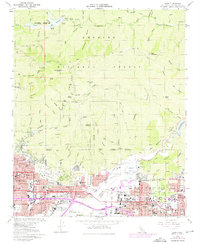
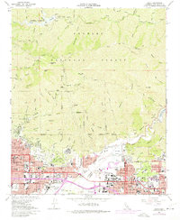
1966 Map of Azusa
USGS Topo · Published 1975About this map
The San Gabriel River carves through the steep mountain terrain of the Angeles National Forest, flowing past high peaks like Monrovia Peak and Rankin Peak toward the suburban expansion below. By the mid-1960s, the foothills and valleys were transitioning into dense residential and industrial corridors, visible in the growth of Monrovia, Duarte, and Azusa. This era saw the significant development of the Santa Fe Flood Control Basin and the prominence of large medical and social institutions like the City of Hope National Medical Center.
Find a feature on this map
79 named features on this map. Tap any name to fly to it.
Don’t see what you’re looking for? This feature index may not catch every label — zoom into the map to look around manually.
Map Details
Editions of this 1966 Azusa Map
5 editions found
Other maps of this area

1894 · Los Angeles
USGS Topo · 1:62,500

1894 · Pomona
USGS Topo · 1:62,500

1896 · Pasadena
USGS Topo · 1:62,500

1897 · Pomona
USGS Topo · 1:62,500

1898 · Pomona
USGS Topo · 1:62,500

1900 · Pasadena
USGS Topo · 1:62,500

1900 · Tujunga
USGS Topo · 1:62,500

1900 · Los Angeles
USGS Topo · 1:62,500

1901 · Southern California Sheet No. 1
USGS Topo · 1:250,000

1903 · Rock Creek
USGS Topo · 1:62,500