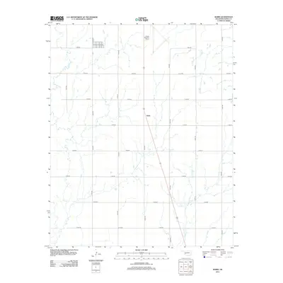
2012 Map of Babbs
USGS Topo · Published 2012About this map
The settlement of Babbs sits within a landscape defined by an extensive grid of section-line roads and the winding paths of western Oklahoma waterways. In this 2012 snapshot, the area serves as a transit point between the meandering Elk Cr to the west and W Otter Cr to the southeast. The geometric precision of the rural road network, including corridors such as E1400 Rd and N2200 Rd, illustrates the organized agricultural partition of the southern Great Plains. Dominating the northern portion of the quadrangle is the Hobart Regional Airport, showing its expansive runway layout as a modern industrial anchor in Kiowa County. This survey reflects the enduring spatial layout of rural Oklahoma, where scattered homesteads and ranches are linked by miles of dirt and gravel roads that follow the historic land surveys.
Find a feature on this map
19 named features on this map. Tap any name to fly to it.
Don’t see what you’re looking for? This feature index may not catch every label — zoom into the map to look around manually.
Map Details
Editions of this 2012 Babbs Map
This is the sole edition of this map. No revisions or reprints were ever made.
Other maps of this area

1949 · Cooperton
USGS Topo · 1:62,500

1955 · Lawton
USGS Topo · 1:250,000

1955 · Clinton
USGS Topo · 1:250,000

1956 · Glen Mountains
USGS Topo · 1:24,000

1956 · Rainy Mountain Creek
USGS Topo · 1:24,000

1956 · Cooperton
USGS Topo · 1:62,500

1957 · Clinton
USGS Topo · 1:250,000

1961 · Gotebo
USGS Topo · 1:62,500

1961 · Hobart
USGS Topo · 1:62,500

1963 · Babbs
USGS Topo · 1:24,000